Mars - Topography Overview
Let's start by examining the the global topography of Mars. This topography was taken by a now-defunct laser altimeter and is referred to as MOLA topgraphy (A variety of versions, can be found here). The elevations in this diagram range from less than - 8 km (dark blues) to higher than 12 km (white). On Earth the "datum", or the elevation assigned a value of 0, is defined by the elevation of sea level. On Mars sea level cannot be used because there are currently no oceans on the planet so a datum of zero elevation has been defined in relation to a constant atmospheric pressure.
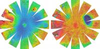
A few things stand out immediately. The majority of the southern portion of the planet is higher (reds) than the northern portion (blues). There appear to be more craters in the south, including some very large ones. For example, that very large blue basin is called Hellas Planitia (often simply referred to as Hellas basin). It is a 2300 km wide impact crater, which makes it one of the largest impact craters in the solar system (Ottawa to Saskatoon is about that distance) . By contrast the northern hemisphere (blue) has fewer large craters and is predominantly at a lower elevation. It has actually been suggested this North Polar Basin is the result of an early, very large impact. The outline of the blue region actually fits an ellipse with dimensions of approximately 10,600 km x 8,500 km as you can see in the slightly unusual projection here.
The ellipse would have been produced by an oblique impact and later volcanism would have modified the outlines somewhat. If confirmed, this would be the largest impact crater within the solar system. Clearly, cratering has been an important process in shaping the surface. But there is so much more!
The boundary between the southern and northern hemispheres is referred to as the Martian Dichotomy. It marks the change in elevation which varies between 1 km - 3 km and is fairly abrupt in some areas while in other regions the transition is more gradual. The shades of green of the dichotomy are disrupted by a large region of high elevations (red). This is the Tharsis region, which may also be referred to as the Tharis bulge (its high!). Here is a closer view of it:
The Tharsis region is a ~10 km high (hence bulge) plateau that is thought to be largely of volcanic origin. We will say more about it when we address Martian volcanism in more detail. For now let us introduce a few more of the spectacular features that can be found here. Those three aligned white peaks are three large volcanoes, the Tharsis Montes. The very tall white peak further to the west is Olympus Mons, the largest volcano in the solar system. And last, but certainly not least, that long valley in shades of blue on the eastern side of Tharsis is Valles Marineris, a 4000 km long and up to 11 km deep system of chasms.
This concludes our global tour of the Martian topography and the large scale features we find in it. Cratering is an important process on Mars but it obviously has more to offer. In the subsequent pages we will take a closer look at some of these other features.